

You can find on this page the New Delhi topographic map to print and to download in PDF. The New Delhi elevation map present the topography, river and relief of New Delhi in India.

The New Delhi topographic map shows elevation, hills and landforms in New Delhi. This elevation map of New Delhi will allow you to know topography, river and relief of New Delhi in India. The New Delhi topographic map is downloadable in PDF, printable and free.
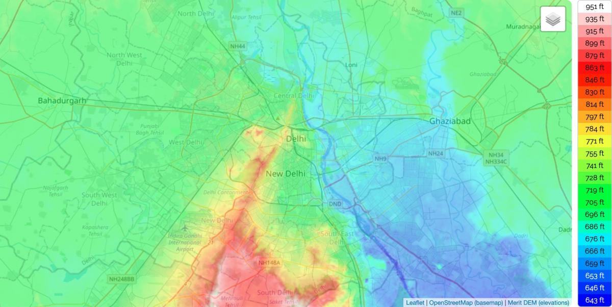
With a total area of 42.7 km2, New Delhi forms a small part of the Delhi metropolitan area and is located in the Indo-Gangetic Plain because of which there is little difference in the city altitude as its mentioned in New Delhi elevation map. New Delhi and surrounding areas were once a part of the Aravalli Range, but all that is left now is the Delhi ridge, which is also called the Lungs of Delhi. The second feature is the Yamuna floodplains; New Delhi lies west of the Yamuna river, although for the most part, New Delhi is a landlocked city. East of the river is the urban area of Shahdara. New Delhi falls under the seismic zone-IV, making it vulnerable to earthquakes.
All the earlier locations of New Delhi fall within a triangular area of about 70 square miles (180 square km), commonly called the Delhi Triangle. Two sides of the triangle are articulated by the rocky hills of the Aravalli Range—one to the south of the city, the other on its western edge, where it is known as the Delhi Ridge. The third side of the triangle is formed by the shifting channel of the Yamuna River. Between the river and the hills lie broad alluvial plains; the elevation of the territory ranges from about 700 to 1,000 feet (200 to 300 metres) as you can see in New Delhi elevation map.
Situated on the banks of river Yamuna, New Delhi is located at 28.38° N and 77.13° E on the northern part of India. There are three major geographical regions: the Yamuna flood plain, the ridge & the Gangetic Plains. The Yamuna flood plains provide fertile soil suitable for agriculture. However, these plains are prone to recurrent floods. With an average altitude of 293 m above sea level as its shown New Delhi elevation map, the ridge forms the most dominating feature in this region. It originates from the Aravalli Hills in the south and encircles the west, north-east and north-west portions of the city. The Great Plains are located in the south of the city and cover most of Delhi.